A diagnostics package to evaluate aerosols in an Earth system model using field campaign measurements
Submitter:
Ma, Po-Lun — Pacific Northwest National Laboratory
Area of research:
Aerosol Processes
Journal Reference:
Science
Earth system model representations of aerosols and their interactions with clouds and radiation are subject to large uncertainties. Model simulations need to be evaluated against real-world measurements to ensure their fidelity in representing observed properties. Existing climate model diagnostics packages are typically used for evaluating climatology, so a detailed evaluation toolkit for aerosol properties is needed. Researchers developed a new diagnostics package that specifically focuses on evaluating aerosol properties with aircraft, ship, and surface measurements.
Impact
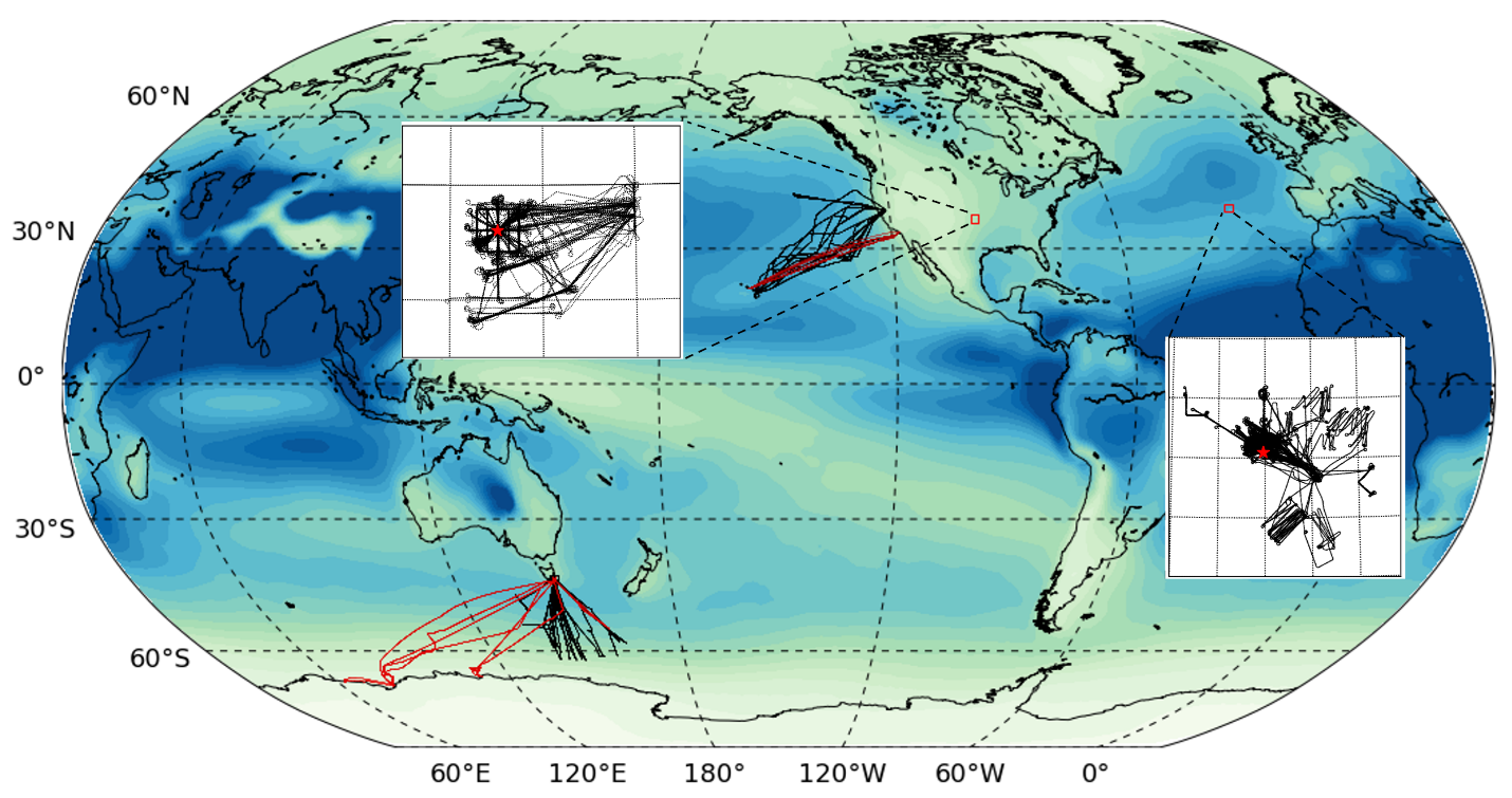
The Earth System Model Aerosol-Cloud Diagnostics (ESMAC Diags) package provides a range of diagnostics and metrics, including time series, diurnal cycles, mean aerosol size distribution, pie charts of aerosol composition, percentiles by height, percentiles by latitude, mean statistics of aerosol number concentration, and more. This allows researchers to quantify model performance in predicting aerosol number, size, composition, vertical distribution, spatial distribution (along ship or aircraft tracks), and new particle formation events. ESMAC Diags is continually extended to clouds and aerosol-cloud interactions and is being applied to evaluate the performances of newly developed physical components in the Energy Exascale Earth System Model (E3SM).
Summary
ESMAC Diags package is a Python-based, open-source package developed to quantify the performance of the Department of Energy’s E3SM atmospheric model using Atmospheric Radiation Measurement user facility and U.S. National Center for Atmospheric Research field campaign measurements. The first version of this diagnostics package focuses on the aerosol properties, including aerosol number, size distribution, chemical composition, and cloud condensation nuclei collected from surface, aircraft, and ship platforms, needed to assess how well a model represents the aerosols across spatial and temporal scales. ESMAC Diags currently includes six field campaigns over the Northeastern Atlantic, Continental U.S., Northeastern Pacific, and the Southern Ocean, respectively. The code structure is designed to be flexible and modular to allow for future extension to other field campaigns or the incorporation of additional data sets.


