Overview

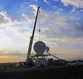
During April and May of 2011, the Midlatitude Continental Convective Clouds Experiment (MC3E) will take place at the ARM Southern Great Plains site in central Oklahoma and is a collaborative effort between the U.S. Department of Energy and the National Aeronautics and Space Administration (NASA). The campaign leverages the largest observing infrastructure currently available in the central United States combined with an extensive sounding array, remote sensing and in situ aircraft observations, NASA ground validation remote sensors, and the new ARM radar instrumentation purchased with funding from the American Recovery and Reinvestment Act of 2009. The overarching goal is to provide the most complete characterization data set for convective cloud systems, precipitation, and their environment that has ever been obtained, providing details for the representation of cumulus clouds in computer models that have never before been available.
Convective processes play a critical role in the Earth’s energy balance through the redistribution of heat and moisture in the atmosphere and subsequent impacts on the hydrologic cycle. Global observation and accurate representation of these processes in numerical models is vital to improving the current understanding and future simulations of earth system processes. Despite improvements in computing power, current operational weather and earth system models are unable to resolve the natural temporal and spatial scales that are associated with convective and stratiform precipitation processes.
MC3E will use a new multiscale observing strategy with the participation of a network of distributed sensors (both passive and active). The objective is to document and monitor in 3D not only precipitation, but also clouds, winds, and moisture in an attempt to provide a holistic view of convective clouds, their environment, and associated feedbacks.
Keep up with the Atmospheric Observer
Updates on ARM news, events, and opportunities delivered to your inbox
ARM User Profile
ARM welcomes users from all institutions and nations. A free ARM user account is needed to access ARM data.


