2024 AGU Presentations Featuring ARM Data
Published: 9 January 2025
Editor’s note (January 9, 2025): Registered attendees can watch all recorded content and access the virtual poster gallery via the online meeting platform until February 28, 2025.
The 2024 American Geophysical Union (AGU) Annual Meeting will be held from December 9 to 13 at the Walter E. Washington Convention Center in Washington, D.C., as well as online. With more than 25,000 attendees expected, the meeting might feel overwhelming. We make it easy for you to find ARM-relevant science, meet up with colleagues, and discover new connections during the event.
Below is a list of ARM-related AGU meeting highlights (all times Eastern). Session/presentation IDs are subject to change; please check the AGU Annual Meeting website and download the meeting app for the most up-to-date information. Follow us on LinkedIn and Facebook for a real-time guide to relevant activities using the hashtags #ARMAGU and #AGU24.
Discover more ARM-related presentations and posters, as well as sessions, talks, and posters related to Atmospheric System Research (ASR).
Add your presentation to be featured on the ARM or ASR presentation web pages.
Attending AGU in person? Make sure to visit the ARM booth (#338) and ASR at the U.S. Department of Energy’s (DOE) Office of Science Biological and Environmental Research (BER) program booth (#139) in the AGU exhibition hall. There you can view facility materials and meet with ARM and ASR representatives.
NEW for AGU 2024: Only plenary and keynote sessions will be live-streamed; named lectures, Union sessions, oral sessions, and town halls will be available for on-demand viewing only. Check the AGU schedule for more information.
CoURAGE Investigators’ Meeting
Lead scientist Ken Davis, Pennsylvania State University, will lead a Coast-Urban-Rural Atmospheric Gradient Experiment (CoURAGE) investigators’ meeting on Tuesday, December 10, from 4:30 to 6 p.m. in the Georgetown University room at the Marriott Marquis.
Check Out ARM-Related Presentations:
Town Halls
DOE Town Halls
- TH13A: DOE’s Earth and Environmental Systems Sciences Division Strategic Priorities
Monday, December 9, 12:30–1:30 p.m., Room 206 (Convention Center)
Primary Contact: Daniel B. Stover, DOE
Presenters: Daniel B. Stover, Gerald L. Geernaert, Renu Joseph, and Jeff Stehr, DOE
- TH45H: A Unified Earth Science Data Infrastructure to Achieve a New Level of Science: Opportunities and Challenges
Thursday, December 12, 6–7 p.m., Room 209 A–C (Convention Center)
Primary Contact and Presenter: Pamela Weisenhorn, Argonne National Laboratory
- TH53E: Advancing Coastal Research in the Southeast United States: Insights from a DOE Environmental System Science Workshop
Friday, December 13, 12:30–1:30 p.m., Capitol/Congress (Marriott Marquis)
Primary Contact: Brian Benscoter, DOE
Presenters: Elizabeth Herndon, Oak Ridge National Laboratory; Xingyuan Chen, Pacific Northwest National Laboratory; Ken Krauss, U.S. Geological Survey; Havalend Steinmuller, University of South Alabama
- TH53G: Atmospheric and Ocean Science for Wind Energy at DOE
Friday, December 13, 12:30–1:30 p.m., Salon I (Convention Center)
Primary Contact and Presenter: Shannon R. Davis, DOE
Related Interagency Town Halls
- TH23A: A Discussion with Program Managers for Early-Career Scientists
Tuesday, December 10, 12:30–1:30 p.m., Marquis 1–2 (Marriott Marquis)
Primary Contact: Alyssa M. Stansfield, University of Utah
Presenters: Alyssa M. Stansfield, University of Utah; Daniel Barrie, NOAA; Eric Thomas DeWeaver, National Science Foundation; Shaima Nasiri, DOE
- TH23E: AmeriFlux Town Hall: What’s Next for AmeriFlux Science
Tuesday, December 10, 12:30–1:30 p.m., Marquis 3–4 (Marriott Marquis)
Primary Contact: Margaret S. Torn, Lawrence Berkeley National Laboratory
Presenters: Daniel B. Stover, DOE; Sébastien Biraud, Trevor F. Keenan, You-Wei Cheah, and Leila Constanza Hernandez Rodriguez, Lawrence Berkeley National Laboratory; Dario Papale, University of Tuscia
- TH23L: USGCRP Coordination of Urban Climate Research in the Federal Agencies
Tuesday, December 10, 12:30–1:30 p.m., Marquis 12–13 (Marriott Marquis)
Primary Contact: Gerald L. Geernaert, DOE
Presenters: Ben DeAngelo, NOAA; Virginia Burkett, U.S. Geological Survey
- TH25G: Building Trust in Science Through Relevance Before Crisis Strikes
Tuesday, December 10, 6–7 p.m., Marquis 1–2 (Marriott Marquis)
Primary Contact: Genoa Johnson, Pacific Northwest National Laboratory
Presenters: Speakers planned from National Geographic, NASA, and Oak Ridge National Laboratory
- TH45D: Developing a Community of Practice for Decision-Relevant Climate Data Products
Thursday, December 12, 6–7 p.m., Marquis 1–2 (Marriott Marquis)
Primary Contact: Renu Joseph, DOE
Presenters: James M. Kuperberg, DOE; Kevin Hiers, U.S. Department of Defense; Daniel Barrie, NOAA; Paul Ullrich, Lawrence Livermore National Laboratory; Daniel Feldman, Lawrence Berkeley National Laboratory
ARM-Related Presentations
Oral Presentations
Please note: On average, each oral presentation is scheduled to run no longer than fifteen minutes, so full session times are listed below for planning purposes.
- A44B-07: Improving Classifications of Thermodynamic Cloud Phase using Machine Learning Methods and Atmospheric Radiation Measurement (ARM) User Facility Value Added Products (VAPs). Lexie Goldberger, Pacific Northwest National Laboratory.
Thursday, December 12, 4–5:30 p.m., Room 154 A–B (Convention Center)
- ED52C-03: Embracing Open Science: The Evolution of the Department of Energy Atmospheric Radiation Measurement User Facility. Adam Theisen, Argonne National Laboratory.
Friday, December 13, 10:20–11:50 a.m., Marquis 12–13 (Marriott Marquis)
Posters
- A11O-1837: Leveraging Computer Vision Algorithms for Enhanced Data Quality Control at the Atmospheric Radiation Measurement (ARM) User Facility. Mia Li, University of Oklahoma.
Monday, December 9, 8:30–12:20 p.m., Hall B–C, Poster Hall (Convention Center)
- A41S-1836: DOE ARM User Facility Tethered Balloon System. Gabrielle Whitson, Sandia National Laboratories.
Thursday, December 12, 8:30 a.m.–12:20 p.m., Hall B–C, Poster Hall (Convention Center)
- A53R-2490: The U.S. DOE ARM User Facility Establishes a New Climate Observatory for Studies of Land-Aerosol-Cloud Interactions in the Southeastern US. Chongai Kuang, Brookhaven National Laboratory.
Friday, December 13, 1:40–5:30 p.m., Hall B–C, Poster Hall (Convention Center)
Invited Presentations
Oral Presentations
Please note: On average, each presentation is scheduled to run no longer than fifteen minutes, so the full session times are listed below for planning purposes.
- A32C-01: Changes in Convection Populations over the US with Warming: Insights from Conceptual, Cloud-Resolving, and Global Climate Models. L. Ruby Leung, Pacific Northwest National Laboratory.
Wednesday, December 11, 10:20–11:50 a.m., Room 201 (Convention Center)
- A43O-02: Observations of Locally Narrow Characteristic Droplet Size Distributions in Stratocumulus Clouds and their Implications for Cloud Representations. Nithin Allwayin, Michigan Technological University.
Thursday, December 12, 2:10–3:40 p.m., Room 201 (Convention Center)
- A44F-03: Urban Coastal Environmental Systems with particular focus on Southeast US and the IPCC City Climate Special Report. Dev Niyogi, University of Texas at Austin.
Thursday, December 12, 4–5:30 p.m., Room 152 B (Convention Center)
- A44F-05: The Spatiotemporal Variability of Clouds and Precipitation During TRACER and ESCAPE. Zackary Mages, Stony Brook University.
Thursday, December 12, 4–5:30 p.m., Room 152 B (Convention Center)
- A54C-01: Mixed Phase Aerosol-Cloud Interactions over the Southern Ocean. Christina S. McCluskey, University Corporation for Atmospheric Research.
Friday, December 13, 4–5:30 p.m., Room 152 B (Convention Center)
- A54C-05: Tethered Balloon Measurements Reveal Enhanced Aerosol Occurrence Aloft Interacting With Arctic Low-level Clouds. Christian Pilz, Leibniz Institute for Tropospheric Research.
Friday, December 13, 4–5:30 p.m., Room 152 B (Convention Center)
Posters
- A06-05: Study of Vertical Distribution and Influence of Boundary Layer Dynamics on New Particle Formation. Gannet Hallar, University of Utah.
Monday, December 9, to Friday, December 13, 8 a.m.–5:30 p.m., iPoster Gallery (Online)
- GC23E-0301: Are atmospheric models too cold in the mountains? William J. Rudisill, Lawrence Berkeley National Laboratory.
Tuesday, December 10, 1:40–5:30 p.m., Hall B–C, Poster Hall (Convention Center)
Featured Field Campaign Presentations
Eastern Pacific Cloud Aerosol Precipitation Experiment (EPCAPE)
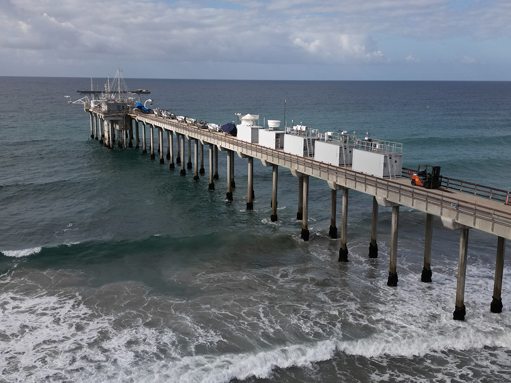
The Eastern Pacific Cloud Aerosol Precipitation Experiment (EPCAPE), which kicked off in La Jolla, California, in February 2023 and ran through February 2024, explored aerosol indirect effects on stratocumulus clouds to help improve their representation in earth system models. EPCAPE included the deployment of an ARM mobile observatory on the Ellen Browning Scripps Memorial Pier and a scanning cloud radar on Mount Soledad less than a mile inland.
Using data collected during EPCAPE, researchers will explore how pollution from the nearby Los Angeles metropolitan area affects marine aerosols and, by extension, the clouds near San Diego.
- POSTER SESSION—A21C: Boundary Layer Clouds and Climate Change I
Tuesday, December 10, 8:30 a.m.–12:20 p.m., Hall B–C, Poster Hall (Convention Center)
Reported EPCAPE presentation:- A21C-1698: Annual Cycle of Cloud Droplet Microphysics Observed In Situ During the Eastern Pacific Cloud Aerosol Precipitation Experiment (EPCAPE). Lauren Robinson, Dalhousie University.
- POSTER SESSION—A31F: Atmospheric Aerosol Processes, Properties, and Impacts Across Scales I
Wednesday, December 11, 8:30 a.m.–12:20 p.m., Hall B–C, Poster Hall (Convention Center)
Reported EPCAPE presentation:- A31F-1790: Influence of Gas Phase Compounds on CCN Activity Observed During the Eastern Pacific Cloud Aerosol Precipitation Experiment. Elavarasi Ravichandran, University of California, Riverside.
- ORAL SESSION—A34D: Boundary Layer Clouds and Climate Change II
Wednesday, December 11, 4–5:30 p.m., Room 202 A (Convention Center)
Reported EPCAPE presentation:- A34D-08: Eastern Pacific Marine Boundary Layer Stratocumulus Cloud Processing of Aerosol. Allison C. Aiken, Los Alamos National Laboratory.
- ORAL SESSION—A43O: Advances in Cloud and Precipitation Processes: Integrating Observations, Modeling, and Theory III
Thursday, December 12, 2:10–3:40 p.m., Room 201 (Convention Center)
Reported EPCAPE presentation:- A43O-07: Understanding the Atmospheric Circulation and Boundary Layer Processes Impacting Cloud Properties and Modulating Aerosol Transport Pathways over the Coastal Northeast Pacific during EPCAPE. Seethala Chellappan, Analytical Mechanics Associates Inc.
- POSTER SESSION—A51S: Multiphase Chemistry at Atmospherically Relevant Interfaces I
Friday, December 13, 8:30 a.m.–12:20 p.m., Hall B–C, Poster Hall (Convention Center)
Reported EPCAPE presentation:- A51S-1954: The OH Radical Burst from Aerosols: Measurements Using an Automated Direct-to-Reagent System During the Eastern Pacific Cloud Aerosol Precipitation Experiment. Catherine Banach, University of California, Los Angeles.
Surface Atmosphere Integrated Field Laboratory (SAIL)
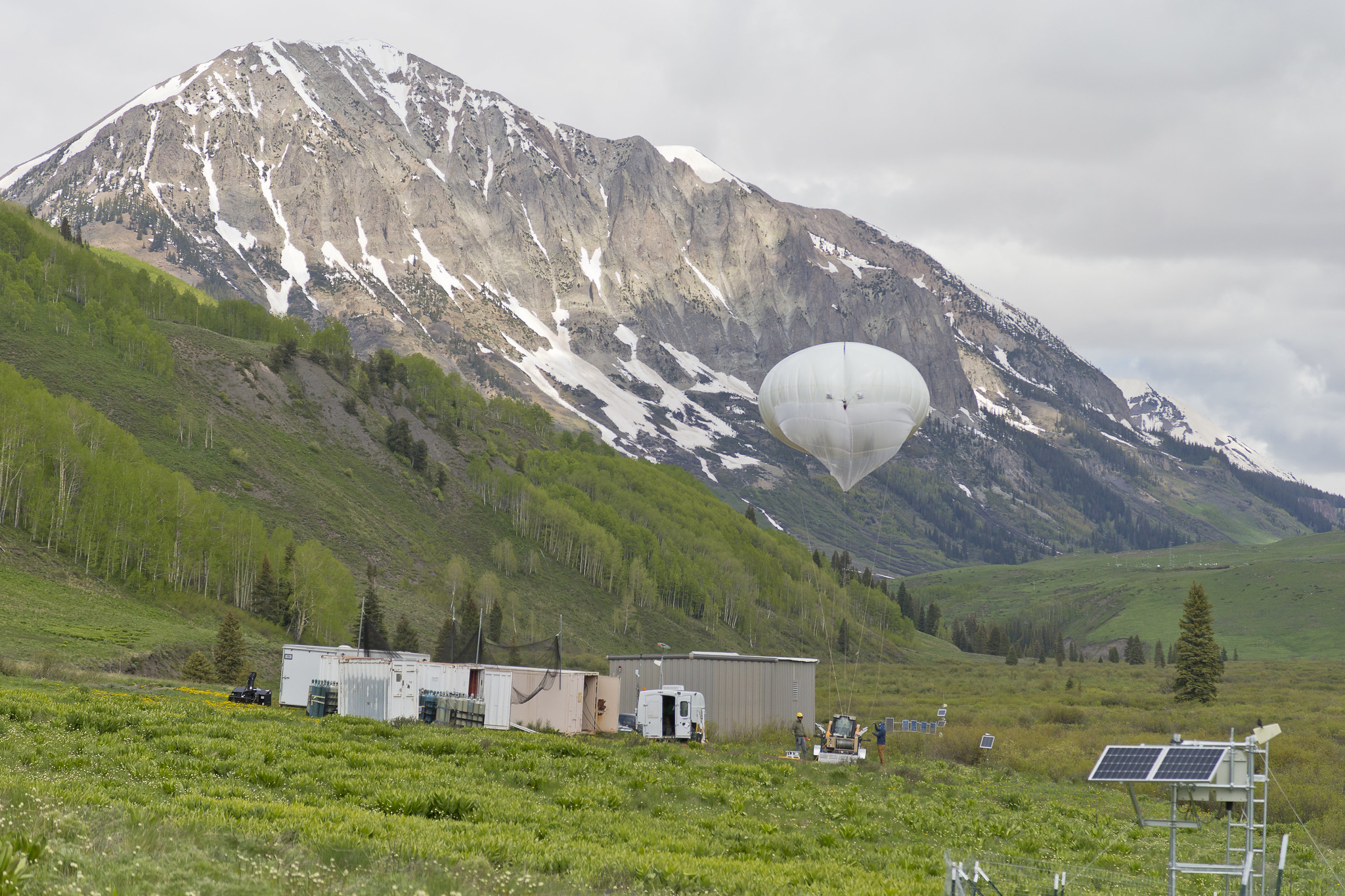
The Surface Atmosphere Integrated Field Laboratory (SAIL) field campaign, which operated from September 2021 to June 2023, took place in the 300-square-kilometer (116-square-mile) East River Watershed near Crested Butte, Colorado. As part of SAIL, an ARM mobile observatory provided valuable atmospheric data that researchers can use to develop detailed measurements of mountainous water-cycle processes pertaining to the Colorado River, which supplies water for 40 million people in the Western United States.
Through SAIL, researchers from national laboratories, universities, research centers, and agencies will enable an atmosphere-through-bedrock understanding of mountainous water cycles.
- ORAL SESSION—C11B: Remote Sensing of the Cryosphere: Seasonal Snow I
Monday, December 9, 8:30–10 a.m., Room 101 (Convention Center)
Reported SAIL presentation:- C11B-06: Observations of super-unit albedo in complex terrain: Explaining, correcting, and interpreting this phenomenon for measurement-model intercomparisons. Daniel Feldman, Lawrence Berkeley National Laboratory.
- POSTER SESSION—C21E: Quantifying Spatial and Temporal Variability of Snow and Snow Processes II
Tuesday, December 10, 8:30 a.m.–12:20 p.m., Hall B–C, Poster Hall (Convention Center)
Reported SAIL presentation:- C21E-0395: Snow bedforms observed with terrestrial scanning lidar. Marianne Cowherd, Pacific Northwest National Laboratory.
- POSTER SESSION—GC23E: Drowning in Data: Guiding Climate Data Users Through the Next Generation of Climate Big Data
Tuesday, December 10, 1:40–5:30 p.m., Hall B–C, Poster Hall (Convention Center)
Reported SAIL presentation:- GC23E-0301: Are atmospheric models too cold in the mountains? (Invited). William J. Rudisill, Lawrence Berkeley National Laboratory.
- POSTER SESSION—A31J: Contribution of Natural Aerosols to Uncertainty in Aerosol Climate Forcing
Wednesday, December 11, 8:30 a.m.–12:20 p.m., Hall B–C, Poster Hall (Convention Center)
Reported SAIL presentation:- A31J-1864: The curious case of invisible dust in snowfall and snowpack in the Upper Colorado River Basin. Leah Gibson, Lawrence Berkeley National Laboratory.
- POSTER SESSION—A31F: Atmospheric Aerosol Processes, Properties, and Impacts Across Scales I
Wednesday, December 11, 8:30 a.m.–12:20 p.m., Hall B–C, Poster Hall (Convention Center)
Reported SAIL presentation:- A31F-1792: Surface Atmosphere Integrated Field Laboratory (SAIL) Measurements: A Study on Application of Machine Learning for the Characterization of Primary Biological Aerosol Particles. Ashfiqur Rahman, Pacific Northwest National Laboratory.
- ORAL SESSION—A33F: Atmospheric Aerosol Processes, Properties, and Impacts Across Scales II
Wednesday, December 11, 2:10–3:40 p.m., Room 201 (Convention Center)
Reported SAIL presentation:- A33F-07: Predicting cloud condensation nuclei (CCN) number concentration using measurements of bulk aerosol size and composition. Maria A. Zawadowicz, Brookhaven National Laboratory.
- POSTER SESSION—A43N: The Spectral Dimension of Shortwave and Longwave Radiation in the Earth System II
Thursday, December 12, 1:40–5:30 p.m., Hall B–C, Poster Hall (Convention Center)
Reported SAIL presentation:- A43N-2188: Ensuring Consistent Surface Spectral Albedo Measurements for Evaluation of Land-surface Changes. Hagen Telg, NOAA and University of Colorado, Boulder.
- POSTER SESSION—H43M: Stable Isotopes in the Critical Zone: Methods, Applications, and Process Interpretations III
Thursday, December 12, 1:40–5:30 p.m., Hall B–C, Poster Hall (Convention Center)
Reported SAIL presentation:
TRacking Aerosol Convection interactions ExpeRiment (TRACER)
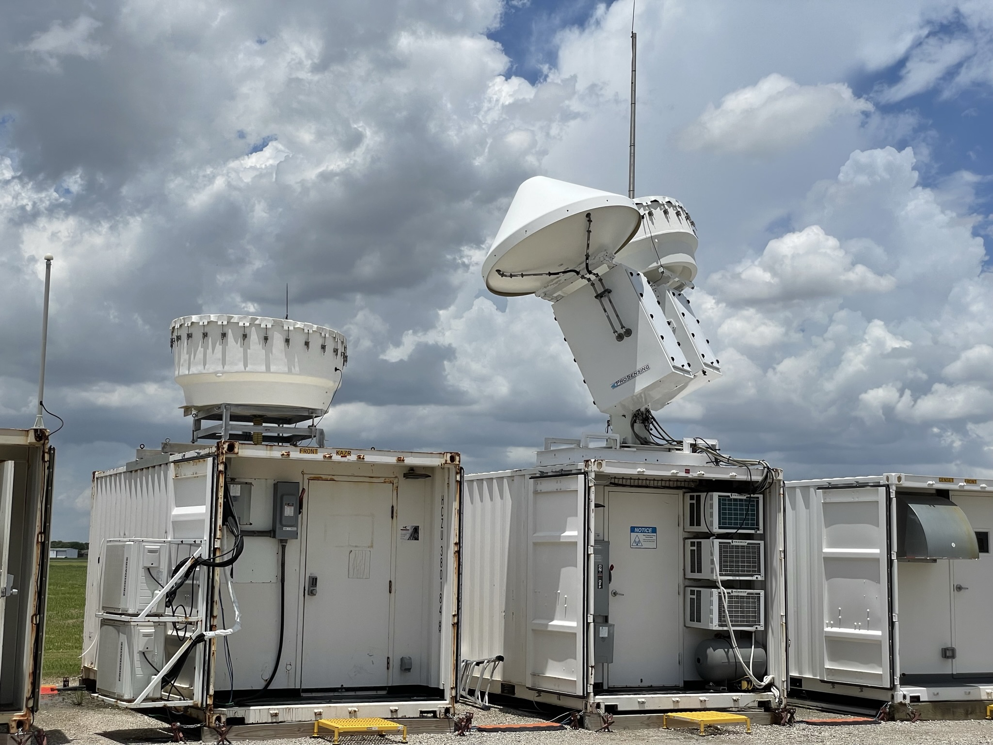
The TRacking Aerosol Convection interactions ExpeRiment (TRACER), which ran from October 2021 through September 2022, provided convective cloud observations with high space and time resolution over a broad range of environmental and aerosol conditions around the Houston, Texas, region.
As part of TRACER, ARM deployed an ARM mobile observatory southeast of downtown Houston, a scanning precipitation radar south of downtown, and an ancillary site southwest of the city, where tethered balloon systems were launched. Together, these ARM measurements are helping researchers better understand the variability of aerosols and meteorology between the urban Houston area and surrounding rural environments.
- POSTER SESSION—A02: Asynchronous Online Poster Presentations: Atmospheric Sciences—Clouds and Radiation
Monday, December 9, to Friday, December 13, 8 a.m.–5:30 p.m., iPoster Gallery (Online)
Reported TRACER presentation:- A02-07: Simplify, simplify, simplify: convective cloud tracking results from a new, unifying toolkit. Travis Hahn, Pennsylvania State University.
- ORAL SESSION—A24B: Atmospheric Convection: Processes, Dynamics, and Links to Weather and Climate IV
Tuesday, December 10, 4–5:30 p.m., Room 201 (Convention Center)
Reported SAIL presentation:- A24B-03: On Investigation of deep convection lifecycle during TRACER with XSACR observation. Min Deng, Brookhaven National Laboratory.
- ORAL SESSION—A24G: Remote Sensing of the Planetary Boundary Layer from Ground, Air, and Space III
Tuesday, December 10, 4–5:30 p.m., Room 202 B (Convention Center)
Reported TRACER presentation:- A24G-08: Creating a 4D Dataset of Atmospheric Boundary-Layer Properties using Field Campaign Data Collected in the Southeast Texas. Katia Lamer, Brookhaven National Laboratory.
- POSTER SESSION—A43A: Advances in Radar Remote Sensing of Clouds and Precipitation: Observations, Data Processing, and Weather and Water Model Applications II
Thursday, December 12, 1:40–5:30 p.m., Hall B–C, Poster Hall (Convention Center)
Reported TRACER presentation:- A43A-1937: Convection cluster identification, tracking, and lifecycle analysis during TRACER. Maggie Graseck, Massachusetts Institute of Technology.
- POSTER SESSION—A51X: Understanding and Modeling of Mesoscale and Severe Local Convective Storm Processes I
Friday, December 13, 8:30 a.m.–12:20 p.m., Hall B–C, Poster Hall (Convention Center)
Reported TRACER presentations:- A51X-2029: Assessing DOE’s global storm-resolving model simulations of deep convection over Houston. Raymond Kwaku Twumasi Oware, University of Houston.
- A51X-2031: Convective Cloud Lifecycle and Merging Behavior in Sea-Breeze Environments: Insights from TRACER observations and WRF Simulations. Dié Wang, Brookhaven National Laboratory.
- POSTER SESSION—A53C: Advancing Understanding of Volatile Organic Compounds: Integrating Modeling and Measurement Approaches II
Friday, December 13, 1:40–5:30 p.m., Hall B–C, Poster Hall (Convention Center)
Reported TRACER presentation:- A53C-2097: Chemistry and Evolution of O3 Precursors in Different O3 Formation Sensitivity Regimes in Houston, Texas. Prakash Sharma, Baylor University.
- POSTER SESSION—A53F: Atmospheric Aerosols and Their Interactions with Clouds, Radiation, and Climate III
Friday, December 13, 1:40–5:30 p.m., Hall B–C, Poster Hall (Convention Center)
Reported TRACER presentation:- A53F-2142: AOD and Particle Concentration: How Do We Develop a Comprehensive Understanding of Aerosol – Cloud Interactions with Diverse Aerosol Data? Hannah C. Vagasky, Atmospheric and Environmental Research.
TRACER’s lead scientist, Michael Jensen, will be the primary convener of the following TRACER-related AGU sessions:
- ORAL SESSION—A44F: Clouds, Precipitation, Aerosols, and Air Quality in the Coastal Urban Environment of Southeastern Texas I
Thursday, December 12, 4–5:30 p.m., Room 152 B (Convention Center)
Reported TRACER presentations:- A44F-02: Evaluating Urban Surface Emissions of Coarse-Mode Particles Using Lidar Retrievals and Large Eddy Simulations.
Ella Ivanova. - A44F-03: Urban Coastal Environmental Systems with particular focus on Southeast US and the IPCC City Climate Special Report (Invited). Dev Niyogi, University of Texas at Austin.
- A44F-04: Assessing the Mass Contribution of Long-Range Transported Biomass Burning Smoke in Houston, TX.
Mackenzie T.S. Ramirez, Baylor University. - A44F-05: The Spatiotemporal Variability of Clouds and Precipitation During TRACER and ESCAPE (Invited). Zackary Mages, Stony Brook University.
- A44F-06: Analysis of a Saharan Dust Event over Houston during the ESCAPE Airborne Flight Campaign. Keyvan Ranjbar, National Research Council Canada.
- A44F-07: Investigating Aerosol Effects on Lightning Production in the Tracking Aerosols and Convection Experiment.
Samuel Gardner, Texas Tech University.
- A44F-02: Evaluating Urban Surface Emissions of Coarse-Mode Particles Using Lidar Retrievals and Large Eddy Simulations.
- POSTER SESSION—A51N: Clouds, Precipitation, Aerosols, and Air Quality in the Coastal Urban Environment of Southeastern Texas II
Friday, December 13, 8:30 a.m.–12:20 p.m., Hall B–C, Poster Hall (Convention Center)
Reported TRACER presentations:- A51N-1877: Aerosol Impacts on the Microphysics of Deep Convective Cells in Simulated TRACER Events. Stephen Millican Saleeby, Colorado State University.
- A51N-1878: Aerosol Particle Hygroscopicity and Aerosol Water Content is Driven by Nitrate and Organics in the Particle Phase in Houston, TX. Amy Christiansen, University of Missouri, Kansas City.
- A51N-1879: Ambient aerosol chemistry in an urban coastal environment during TRACER. Puneet Kumar Verma, Baylor University.
- A51N-1880: Comparisons of Mobile Pandora and In Situ Concentrations of NO2 and HCHO during TRACER-AQ 1 and 2. Davis Earley, Virginia Tech.
- A51N-1881: Causal Analysis of Aerosol Impacts on Isolated Deep Convection: Findings from TRACER. Dié Wang, Brookhaven National Laboratory.
- A51N-1882: Dependence of Convective Cloud Microphysical Properties on Environmental Parameters during the TRACER and ESCAPE Field Campaigns: A Synergistic Approach of Observations, Machine Learning and Numerical Models. Yongjie Huang, University of Oklahoma.
- A51N-1884: Identifying and Characterizing Dust Events in Southeastern Texas Using ARM TRACER Observations. Andrea Suarez-Rosado, University of Puerto Rico, Rio Piedras.
- A51N-1885: Impacts of Planetary Boundary Layer Characteristics on Aerosol Vertical Distribution in a Coastal Urban Environment. Bo Chen, Texas A&M University.
- A51N-1886: Investigating Aerosol and Meteorological Influences on Convective Clouds in Houston, Texas, during the TRACER / ESCAPE Field Campaigns. Ali Al Jabri, University of Oklahoma.
- A51N-1887: Investigating the Complex Interactions Between Meteorology and Aerosols and Their Impacts on the Aerosol Direct Radiative Forcing in Southern Texas Region. Tamanna Subba, Brookhaven National Laboratory.
- A51N-1888: Investigation of Physical Processes Contributing to Coastal Convection Initiation on 2 June 2022 During ESCAPE.
Katherine McKeown, Pennsylvania State University. - A51N-1889: Investigation of convective cell evolution and lifecycle using C-band radar high-temporal resolution cell tracking observations in Houston, TX. Mariko Oue, Stony Brook University.
- A51N-1890: Joint Variability of Cloud-Synoptic Meteorology in 2022 SE Texas: Insights from Negative PDO Years. Jungmin Minnie Park, Brookhaven National Laboratory.
- A51N-1892: Effects of Convective Outflow Boundaries on Aerosol Populations. Seth Thompson, Texas A&M University.
- A51N-1893: Properties of Convective Downdraft Outflow from Isolated Cells Observed during TRACER. Michael P. Jensen, Brookhaven National Laboratory.
- A51N-1894: Variability in Air Quality within Large-Scale Meteorology Regimes in the Houston Metropolitan Region. Breiann Seymore, Texas Southern University.
- A51N-1895: Separate and Combined Effects of Sea Breezes and Cold Pools on Convective Evolution during TRACER. Aryeh J. Drager, Brookhaven National Laboratory.
- A51N-1896: The impact of marine aerosol to refinery emissions on cloud microphysical properties during ESCAPE. Gregory C. Roberts, Scripps Institution of Oceanography.
Multidisciplinary Drifting Observatory for the Study of Arctic Climate (MOSAiC)
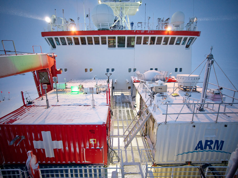
The massive Multidisciplinary Drifting Observatory for the Study of Arctic Climate (MOSAiC) expedition set out to document the atmosphere, sea ice, ocean, biogeochemistry, and ecosystem in the central Arctic. More than 400 field participants and 60 institutions from 20 countries were active in the German-led expedition from September 2019 to October 2020. MOSAiC’s central observatory was the icebreaker R/V Polarstern, which froze into and then drifted with the arctic sea ice for most of the year. ARM provided the most atmospheric instruments—more than 50—to the expedition.
- POSTER SESSION—C21E: Quantifying Spatial and Temporal Variability of Snow and Snow Processes II
Tuesday, December 10, 8:30 a.m.–12:20 p.m., Hall B–C, Poster Hall (Convention Center)
Reported MOSAiC presentation:- C21E-0402: Assessing the Spatial and Temporal Variability of Snow Grain Types on Arctic Sea Ice. Julia Kaltenborn, McGill University and Institute for Snow and Avalanche Research.
- ORAL SESSION—A33F: Atmospheric Aerosol Processes, Properties, and Impacts Across Scales II
Wednesday, December 11, 2:10–3:40 p.m., Room 201 (Convention Center)
Reported SAIL presentation:- A33F-07: Predicting cloud condensation nuclei (CCN) number concentration using measurements of bulk aerosol size and composition. Maria A. Zawadowicz, Brookhaven National Laboratory.
- POSTER SESSION—A43B: Aerosols and Chemistry in Aquatic Environments II
Thursday, December 12, 1:40–5:30 p.m., Hall B–C, Poster Hall (Convention Center)
Reported MOSAiC presentation:- A43B-2025: Revealing the Chemical Composition of Sea Spray Aerosols over the Central Arctic Ocean during the Year-Long MOSAiC Expedition. Tiantian Zhu, University of Michigan, Ann Arbor.
- POSTER SESSION—A53D: Aerosol, Cloud, Precipitation, and Radiation Studies over High-Latitude Oceans I
Friday, December 13, 1:40–5:30 p.m., Hall B–C, Poster Hall (Convention Center)
Reported MOSAiC presentations:- A53D-2109: Fine sea salt aerosol production from blowing snow. Xin Yang, Natural Environment Research Council.
- A53D-2111: The sources and cloud ice forming abilities of biological aerosols in the central Arctic. Jessie Creamean, Colorado State University.
- ORAL SESSION—A54C: Aerosol, Cloud, Precipitation, and Radiation Studies over High-Latitude Oceans II
Friday, December 13, 4–5:30 p.m., Room 152 B (Convention Center)
Reported MOSAiC presentation:- A54C-05: Tethered Balloon Measurements Reveal Enhanced Aerosol Occurrence Aloft Interacting With Arctic Low-level Clouds (Invited). Christian Pilz, Leibniz Institute for Tropospheric Research.
Matthew Shupe, a DOE-funded principal investigator and a co-coordinator of the MOSAiC expedition, will be the primary convener of the following Arctic-themed AGU session:
- POSTER SESSION—C41E: Coupled-System Processes of the Arctic Atmosphere–Sea Ice–Ocean System: Harnessing Field Observations and Advancing Models III
Thursday, December 12, 8:30 a.m.–12:20 p.m., Hall B–C, Poster Hall (Convention Center)
Reported MOSAiC presentations:- C41E-0227: sealvl ponds: An updated parameterization for melt ponds on sea ice in CICE. David Clemens-Sewall, NOAA.
- C41E-0231: Phase-space investigation of lead impacts on the Arctic boundary layer and clouds using high-resolution LES based on year-long MOSAiC data. Niklas Schnierstein, University of Cologne.
- C41E-0234: Arctic sea ice melt is insensitive to thin clouds and inhibited by thick clouds. Matthew Shupe, University of Colorado Boulder.
- C41E-0236: Blowing snow during the 2019-2020 MOSAiC expedition: added perspectives from ICESat-2 and SnowModel-LG.
Joseph Robinson, University of Washington.
Keep up with the Atmospheric Observer
Updates on ARM news, events, and opportunities delivered to your inbox
ARM User Profile
ARM welcomes users from all institutions and nations. A free ARM user account is needed to access ARM data.


