Ceilometer Derived Planetary Boundary Layer Height Datastream Available
Published: 5 May 2014

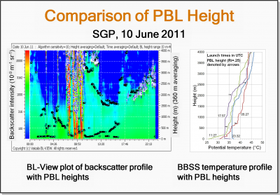
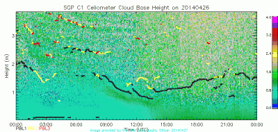
Planetary Boundary Layer (PBL) height data are now being collected at ARM sites and mobile facilities using an enhanced gradient method algorithm from the Vaisala Ceilometers (VCEIL). These data are part of a new datastream available to the ARM and broader scientific community thanks to an evaluation conducted to compare the PBL height measurement from the ceilometer against the balloon-borne sounding systems.
Results from the evaluation were presented at the 2012 ASR Science Team Meeting and received a recommendation from the lidar focus group, PBL height interest group, and Cloud Life Cycle working group that led to the development of a ceilometer-derived PBL height datastream (CEILPBLHT). Vaisala, the manufacturer of the ceilometers purchased under the American Recovery and Reinvestment Act, developed the algorithm, which was tested at the ARM Southern Great Plains site. Final implementation of the updated ingest for the ceilometers was completed at all the sites on February 4, 2014. The new datastream will also be added to the PBL value-added product.

PBL height data are important to a wide range of atmospheric processes. Data for the CEILPBLHT have been collected from Eastern North Atlantic, North Slope Alaska, Southern Great Plains, Tropical Western Pacific, and four different ARM Mobile Facility installations.
As always, feedback and use of the data are welcomed and encouraged. For questions, or to report data problems, please contact VCEIL instrument mentor Victor Morris. To access the CEILPBLHT datastreams, log into the ARM Data Archive. (Go here to request an account).
The ARM Climate Research Facility is a DOE Office of Science user facility. The ARM Facility is operated by nine DOE national laboratories, including .
Keep up with the Atmospheric Observer
Updates on ARM news, events, and opportunities delivered to your inbox
ARM User Profile
ARM welcomes users from all institutions and nations. A free ARM user account is needed to access ARM data.


